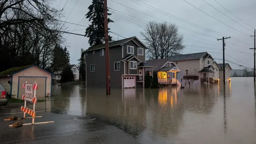
Castle Rock sits between the Cowlitz River and Interstate 5, with the river flowing south past the west side of the city. The National Weather Service gauge turns river height into plain steps, from road flooding at 48 feet to levee warnings at 57.
Key takeaways
- The National Weather Service sets minor flood stage at 48 feet, moderate at 54 feet and major at 57 feet on the Cowlitz River gauge.
- Flooding of buildings and residential areas begins at 51 feet, especially west of the river along Highway 411 and around Four Corners.
- The highest crest on the gauge list is 55.76 feet, on February 8, 1996.
- Provisional crests of 49.01 feet on January 7, 2022, 48.18 feet on December 9, 2025 and 48.08 feet on March 14, 2026 stayed just above minor flood stage, where roads and low lying farmland flood.
- Lewis County says Cowlitz flooding is most common from October through April.
What each level on the gauge means
The gauge reading is the height of the Cowlitz River in feet. The National Weather Service describes what to expect at each height, and the steps are far apart.
- 48 feet, minor: flooding of several roads and low lying farmland in areas not protected by levees.
- 51 feet: flooding of buildings and residential areas begins, especially west of the river along Highway 411 and around Four Corners.
- 54 feet, moderate: widespread flooding of residential and business areas west of the river.
- 57 feet, major: possible overtopping or weakening of the levee that protects the city.
Why 51 feet is the number to remember
Below 51 feet the National Weather Service lists road and farmland flooding. At 51 feet the description turns to buildings, which is the point where interior water damage becomes a concern.
Highway 411 and Four Corners
Four Corners is an area west of the river off West Side Highway that the city plan describes as a commercial hub for residential neighborhoods.
The National Weather Service names it, along with Highway 411, among the places where flooding of buildings is expected once the river passes 51 feet.
The crests on record
The gauge list gives a crest history that puts any new reading in context. Lewis County says the gauge shows major floods in 1959, 1965, 1975 and 1995.
All four crests below were above 51 feet, the height where buildings begin to flood.
- 55.76 feet on February 8, 1996, the highest crest on the list.
- 54.7 feet in January 2009.
- 52.95 feet on May 18, 1980, the day Mount St. Helens erupted.
- 52.45 feet on December 9, 2015.
Recent crests that stayed near minor flood stage
Three recent provisional crests were all close to the 48 foot minor stage: 49.01 feet on January 7, 2022, 48.18 feet on December 9, 2025 and 48.08 feet on March 14, 2026.
At that level the National Weather Service expects roads and low lying farmland to flood. These crests are not records of flooded homes, and no home flooding is claimed for them.
They do show the river reaching the first step three times in about four years.
- Provisional crests may be adjusted later.
- A reading just above 48 feet is a prompt to prepare, not a sign that buildings are taking water.
- Watch for a rise toward 51 feet, where the description changes.
Why sediment keeps the river on watch
In December 2025 the Public Works director told FOX 13 that sediment from Mount St. Helens keeps building up in the Cowlitz River, and that large sandbars show when the water drops.
Officials told FOX 13 that Mount St. Helens sheds about 5 million cubic yards of material a year. A letter to the Army Corps warned that a single above average event could devastate more than 90,000 residents downstream.
Officials describe the build up as a continuing concern for the people who live downstream of the river.
Older floods and the levee
The Castle Rock Walk history page says the flood of 1906 nearly erased the town, that residents sandbagged during the flood of 1933 and that the Army Corps built levees in 1936. It is a single source, so it is best read as local history rather than a measured record.
The 2006 city plan says most of the city lies outside the 100-year floodplain, while some parts of it are in special flood hazard areas. Whether one property is affected is a question for the flood maps and the city, not for a gauge number.
- 1906: the history page says the flood nearly erased the town.
- 1933: residents sandbagged during the flood.
- 1936: the Army Corps built levees.
When river water reaches a building
River water counts as Category 3. It carries silt and contaminants, so it is handled with protective gear, and materials that soaked it up are usually removed.
Storm and flood water cleanup begins with extracting what is standing, using the methods described under water extraction.
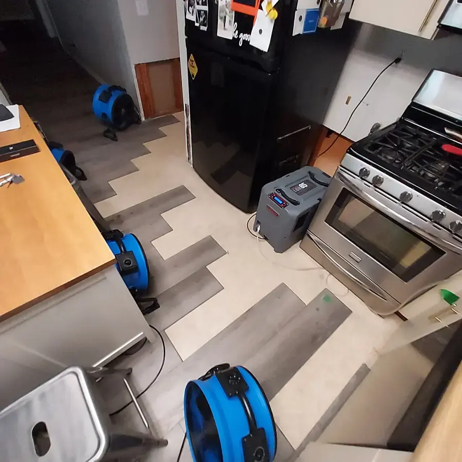
After the water is out, structural drying takes over. Air movers and dehumidifiers dry framing and subfloor while moisture readings track progress.
Drying matters as much as extraction. Wood framing that stays wet for 24 to 48 hours invites mold, so equipment goes in as soon as the standing water and ruined materials are gone.
- Standing water is pumped and extracted first.
- Wet carpet, pad and drywall are removed.
- Surfaces get a cleaning pass and an antimicrobial treatment.
- Drying continues until readings match unaffected areas.
A checklist for the wet season, October through April
The 2006 city plan puts the area's rainfall at roughly 60 inches of precipitation a year, with about 80% of it from October through March. The wet season and the flood season overlap almost exactly.
- Know the four numbers: 48, 51, 54 and 57 feet.
- Move valuables, files and electronics off floors in low rooms.
- Find the main water shutoff and the electrical panel before an emergency.
- Photograph each room so a loss is easy to document.
- After a rise, stay out of floodwater and keep electrical equipment away from wet rooms.
Questions
What is minor flood stage on the Cowlitz River here?
The National Weather Service sets minor flood stage at 48 feet, moderate at 54 feet and major at 57 feet.
At what height do buildings start to flood?
The National Weather Service says flooding of buildings and residential areas begins at 51 feet, especially west of the river along Highway 411 and around Four Corners.
What was the highest crest on the gauge list?
55.76 feet, on February 8, 1996.
Did homes flood in 2022, 2025 or 2026?
The crests of 49.01, 48.18 and 48.08 feet were provisional and only just above minor flood stage, where the National Weather Service lists road and farmland flooding. No home flooding is claimed for them.
Is river water handled differently from rain water?
Yes. River water is Category 3, which calls for protective gear, removal of porous materials and an antimicrobial treatment before drying.
Where is Four Corners?
Four Corners is an area west of the Cowlitz River off West Side Highway. The city plan describes it as a commercial hub for residential neighborhoods, and the National Weather Service names it among the places where buildings flood once the river passes 51 feet.